TAP ResearchPaper018-Wingates
 Richard Carlton
2007, Wingates, Northumberland: An Archaeological and Historical Study of a Northumbrian Township and Estate
Sign up for access to the world's latest research
AI-generated Abstract
The paper presents a comprehensive examination of the historical and architectural significance of Wingates in Northumberland. Utilizing various illustrative materials including maps and aerial photographs, the study delves into the evolution of the area, focusing on key structures and their historical context. Conclusively, it highlights the importance of preserving such heritage sites for future generations.
Figures (407)


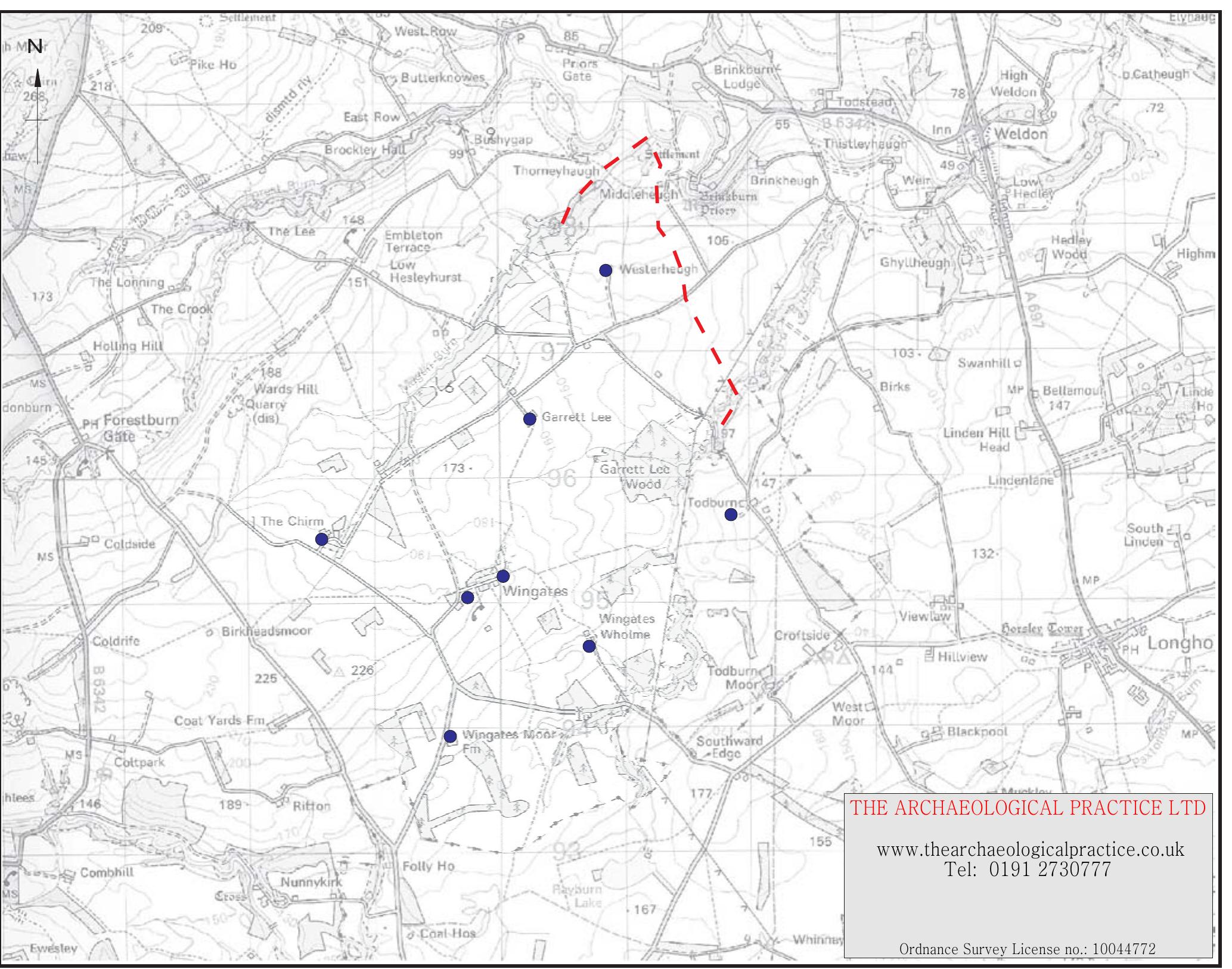


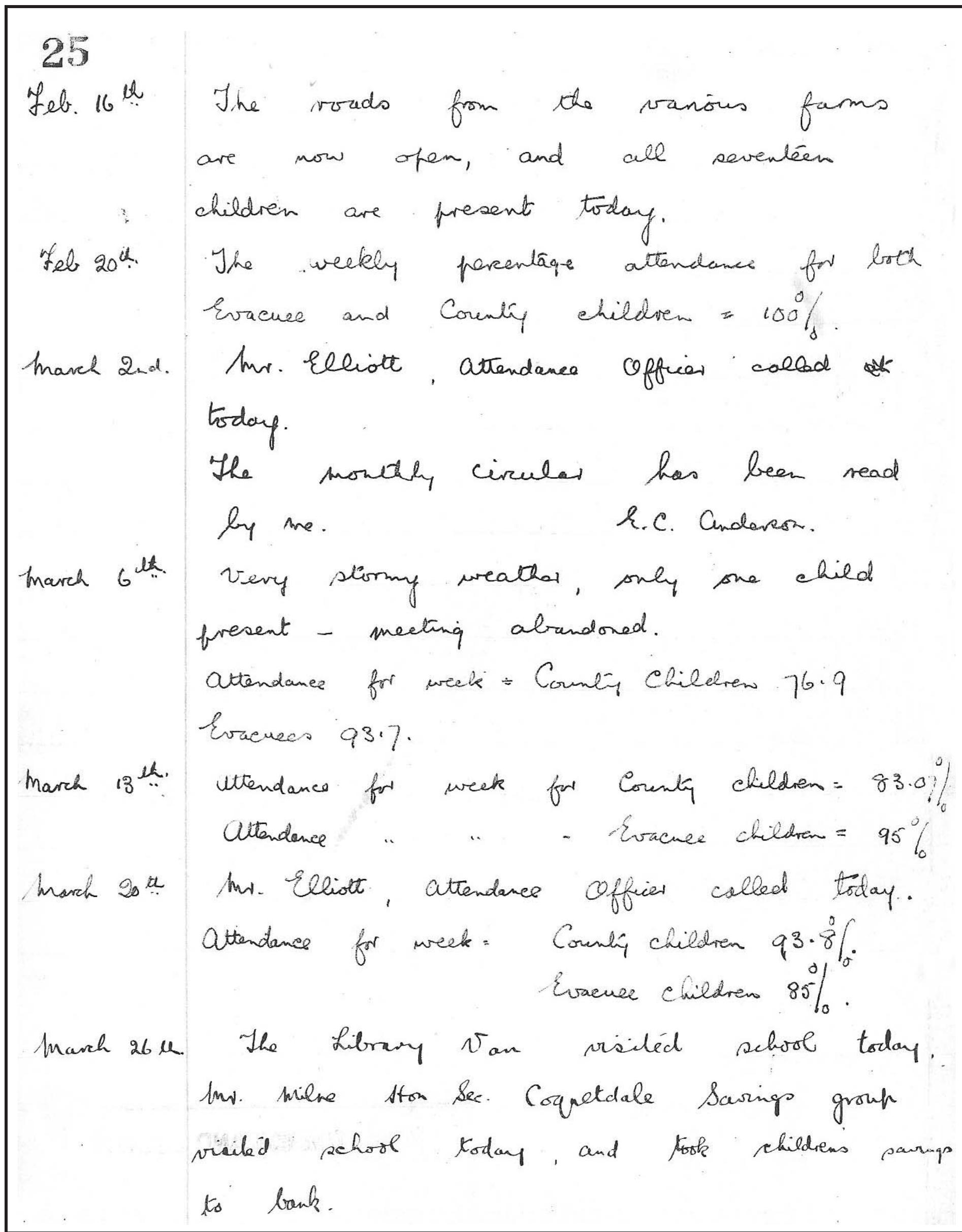
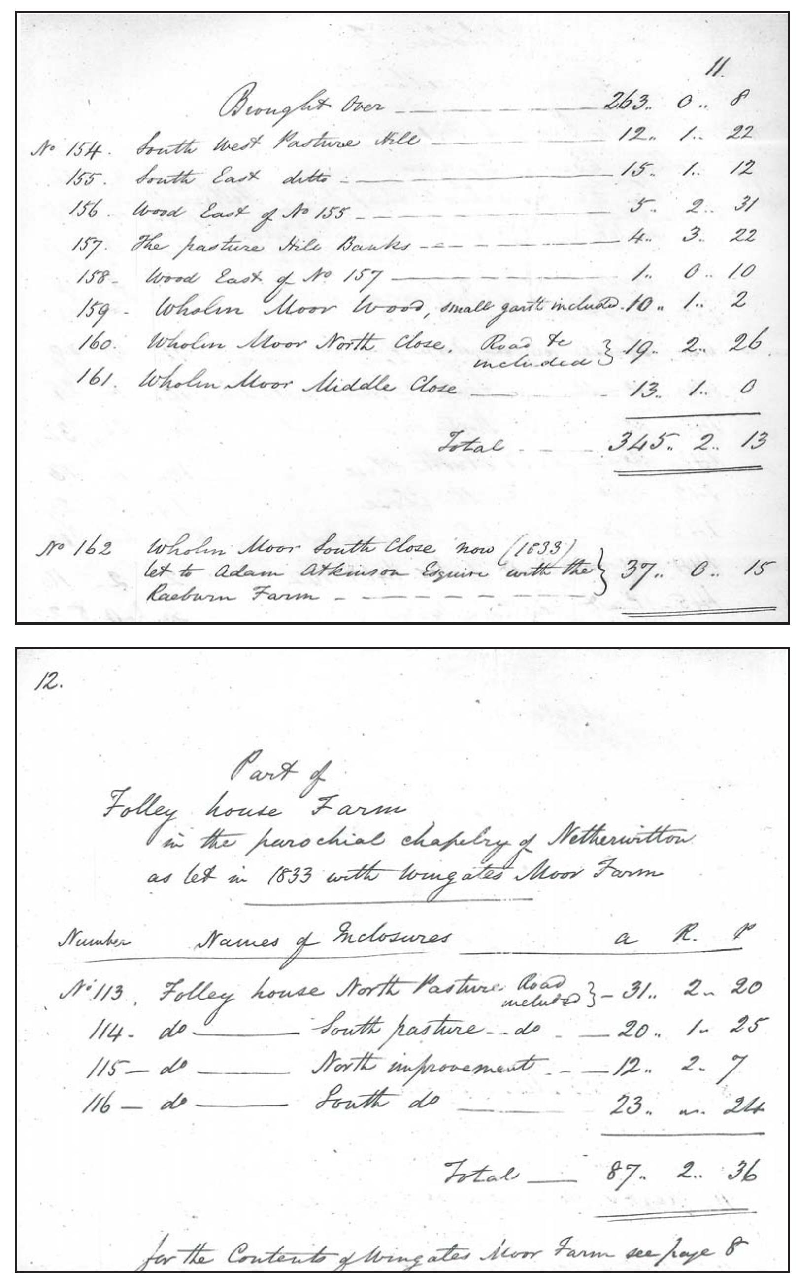
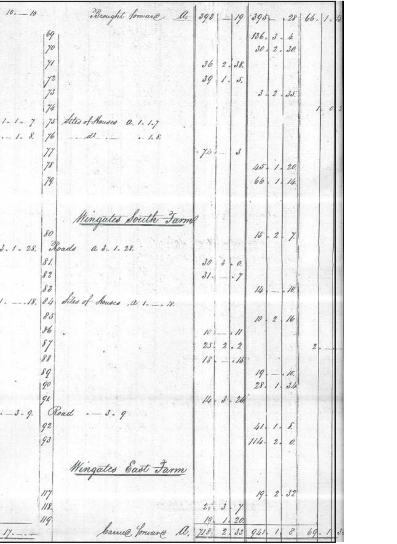
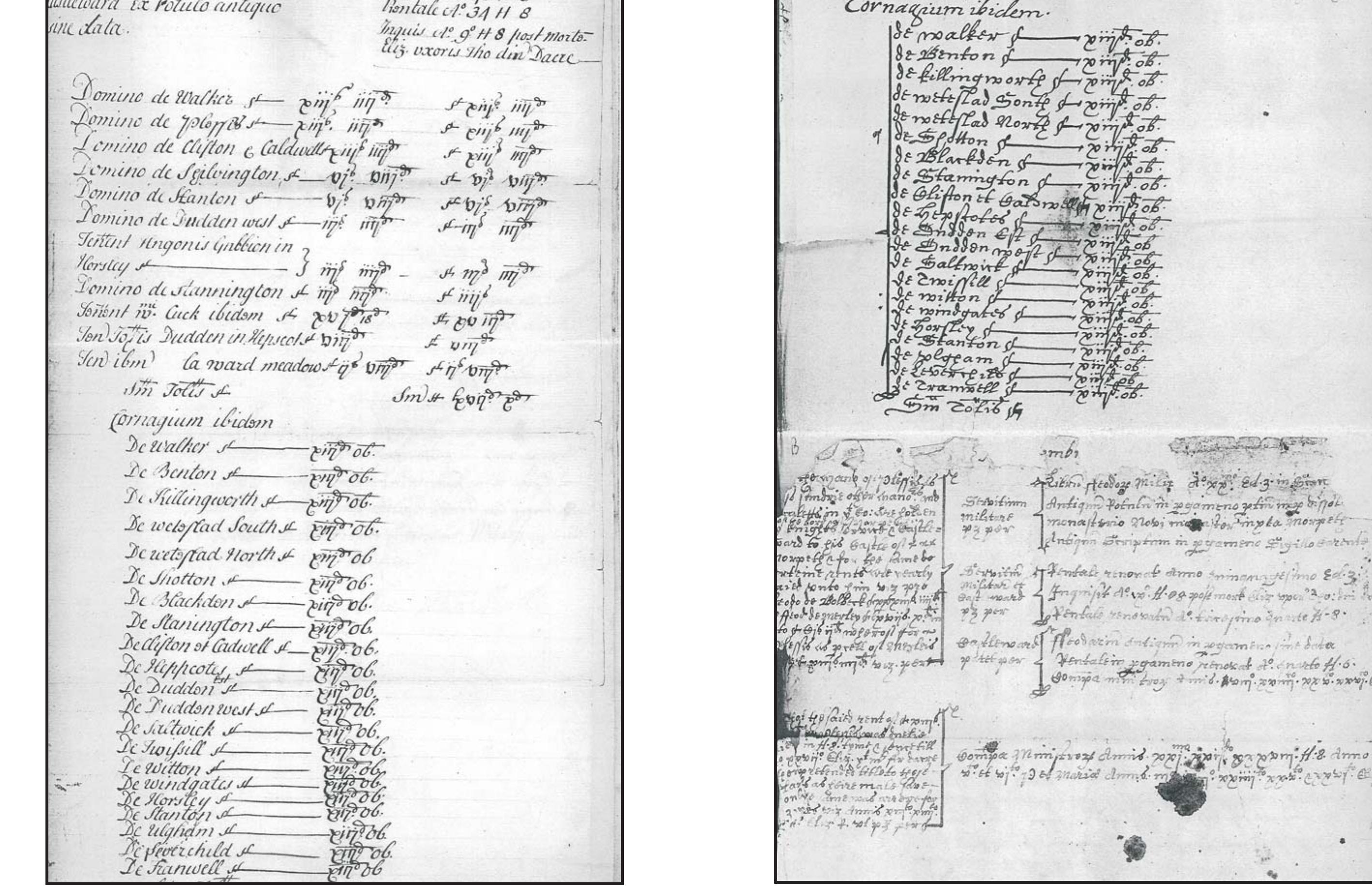
![Table 1: Known sites of cultural heritage importance within the wider study area. A site gazetteer is set out below. Complete entries for those sites listed in the Northumberland Sites and Monuments Record (NSMR) may be consulted by contacting the Conservation Team at County Hall, Morpeth, or in summary form on the ‘Keys to the Past’ website. The gazetteer sites are all located on Illus. 325 and, in the case of those in the immediate vicinity of the village and in the village core, on Illus. 326 and 327 respectively. For further ease of identification the site catalogue numbers are placed between square brackets when cited in the report text. Thus catalogue number 20 would normally appear as [20], although in some cases a site may be more fully identified.](https://figures.academia-assets.com/101176645/table_001.jpg)